


Community Center, Lowndes County, Alabama
About
Outline
Summary
| Unique Area Identifier | 522311 |
| Name | Community Center |
| County | Lowndes County |
| State | Alabama |
| Area (square miles) | 68.10 |
| Land Area (square miles) | 67.62 |
| Water Area (square miles) | 0.47 |
| % of Land Area | 99.30 |
| % of Water Area | 0.70 |
| Latitude of the Internal Point | 32.04015970 |
| Longtitude of the Internal Point | -86.45973920 |
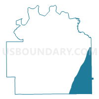
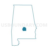
Maps

Graphs
Select a template below for downloading or customizing gragh for Community Center, Lowndes County, Alabama


Neighbors
Neighoring Voting District (by Name) Neighboring Voting District on the Map
- 2M Pintala Volunteer Fire Dept Voting District, Montgomery County, AL
- Fort Deposit National Guard Armory Voting District, Lowndes County, AL
- Lily Baptist Church, Lowndes County, AL
- Lily Baptist Church, Lowndes County, AL
- New Hope Church, Lowndes County, AL
- New Hope Church, Lowndes County, AL
- New Pleasant Valley Church, Lowndes County, AL
- Panola Community Center, Crenshaw County, AL
- STEINER'S STORE, Butler County, AL
Top 10 Neighboring County Subdivision (by Population) Neighboring County Subdivision on the Map
- Greenville CCD, Butler County, AL (13,363)
- Hope Hull CCD, Montgomery County, AL (8,627)
- Petrey-Highland Home CCD, Crenshaw County, AL (3,828)
- Hayneville CCD, Lowndes County, AL (3,620)
- Fort Deposit CCD, Lowndes County, AL (2,886)
Top 10 Neighboring Place (by Population) Neighboring Place on the Map
Top 10 Neighboring Unified School District (by Population) Neighboring Unified School District on the Map
- Montgomery County School District, AL (226,849)
- Butler County School District, AL (20,947)
- Crenshaw County School District, AL (13,906)
- Lowndes County School District, AL (11,299)
Top 10 Neighboring State Legislative District Lower Chamber (by Population) Neighboring State Legislative District Lower Chamber on the Map
- State House District 90, AL (39,991)
- State House District 69, AL (37,572)
- State House District 78, AL (30,880)
Top 10 Neighboring State Legislative District Upper Chamber (by Population) Neighboring State Legislative District Upper Chamber on the Map
- State Senate District 30, AL (139,399)
- State Senate District 26, AL (120,666)
- State Senate District 23, AL (111,939)
Top 10 Neighboring 111th Congressional District (by Population) Neighboring 111th Congressional District on the Map
Top 10 Neighboring Census Tract (by Population) Neighboring Census Tract on the Map
- Census Tract 59.01, Montgomery County, AL (4,865)
- Census Tract 9532, Butler County, AL (4,327)
- Census Tract 7808, Lowndes County, AL (3,620)
- Census Tract 7812, Lowndes County, AL (2,886)
- Census Tract 9527, Butler County, AL (2,439)
- Census Tract 9635, Crenshaw County, AL (1,903)
Top 10 Neighboring 5-Digit ZIP Code Tabulation Area (by Population) Neighboring 5-Digit ZIP Code Tabulation Area on the Map
- 36043, AL (3,666)
- 36032, AL (2,339)
- 36042, AL (1,500)
- 36046, AL (1,490)
- 36047, AL (1,396)
- 36041, AL (1,318)